Image

Steinabrunn Stone Age Sky : This diagram combines an archaeological map (center) with horizon data (black irregular ring) and sky data for the archaeological site. Possible astronomical alignments can immediately be recognized.

Publication

This image has been taken from the following publication:
2006
This diagram combines an archaeological map (center) with horizon data (black irregular ring) and sky data for the archaeological site. Possible astronomical alignments can immediately be recognized. 
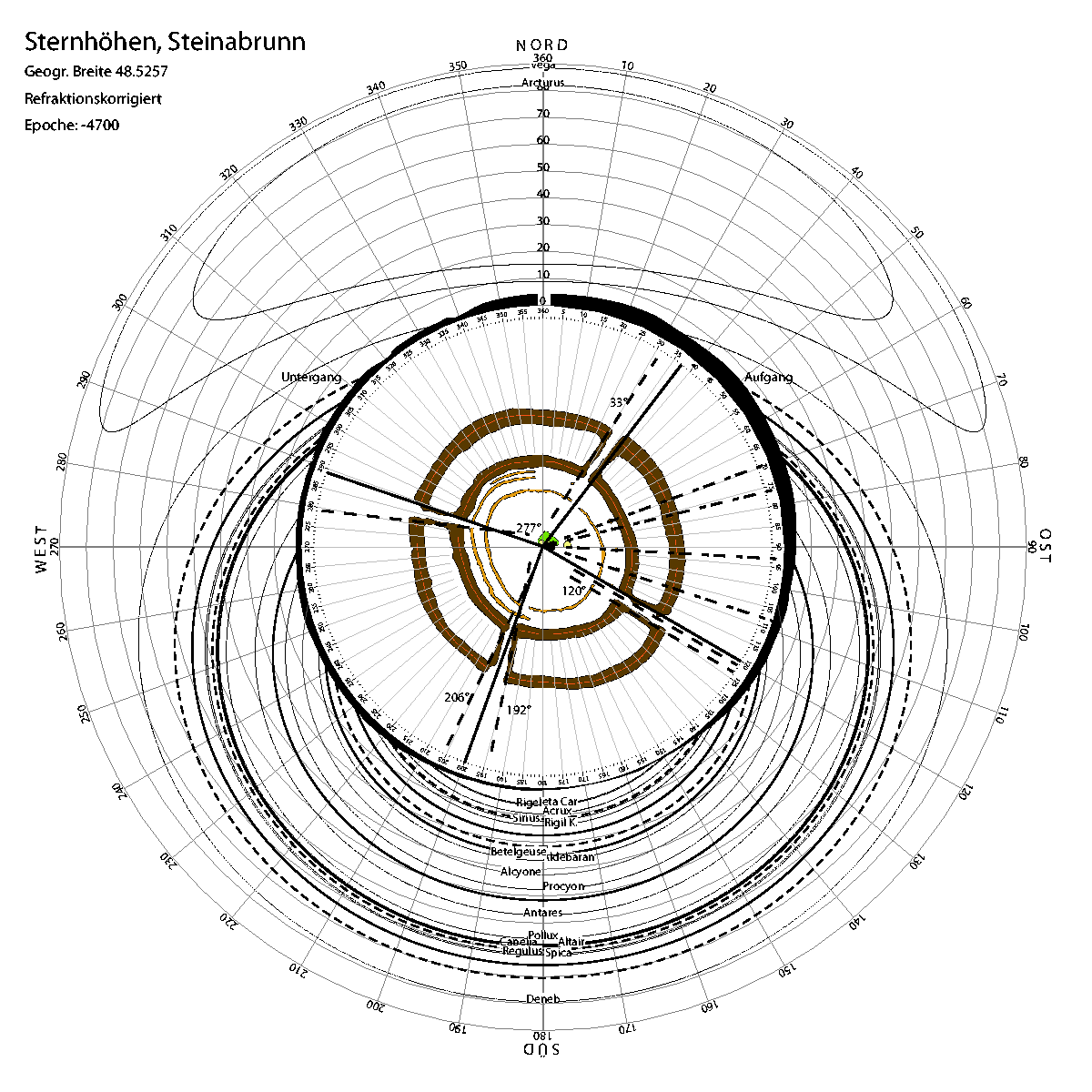
Georg Zotti
A Sky Dome Visualisation for Identification of Astronomical Orientations
Information Visualization, 2006(5):152-166, 2006. [Steinabrunn Stone Age Sky]
Journal Paper (without talk)